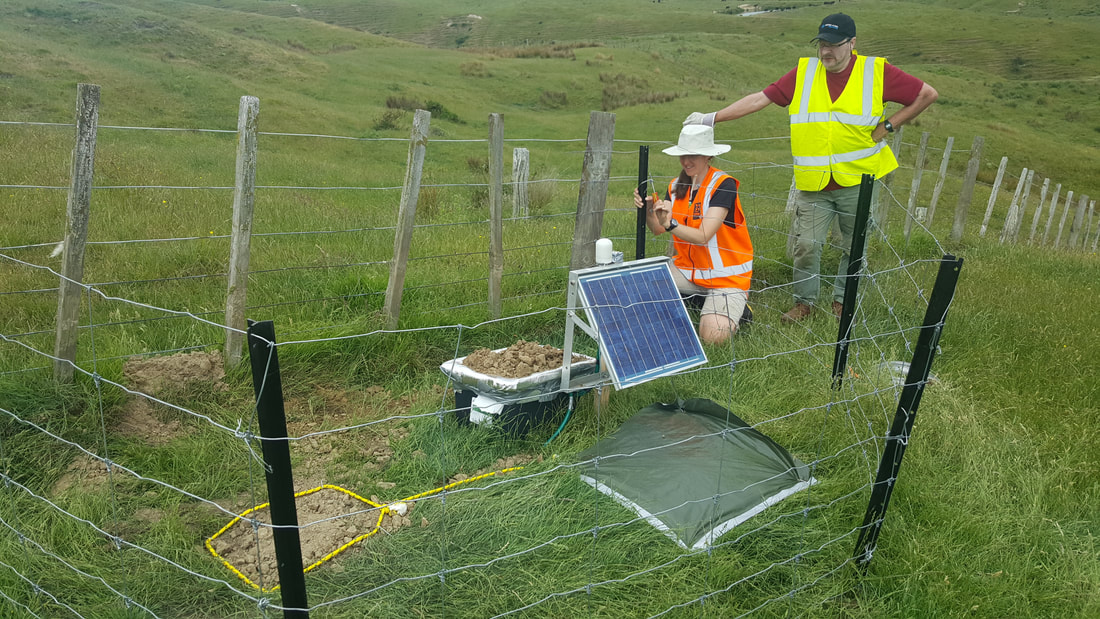
 Seismometers come in many shapes and sizes. In this project we’re using three types; Guralp 6TDs, GFZ cubes and GeoSpace GSXs. And as the NZ3D team have all had to learn, each is installed differently. The 6TD is our all-singing, all-dancing, self-charging, 3-component broadband quake-measurer. Like a superhero, but one that requires some serious manual labour and technical know-how to put in action… The 6TD is put to bed in a 60cm deep hole pointing North and precisely levelled using a spirit level. Through a myriad of cables, it is hooked up to a car battery, which is recharged from a solar panel. The GPS records its location and a fence is built around the site to protect it from curious livestock and locals. With soft ground, no technical hiccups and team of keen beans, this takes about two hours (not including the off-roading and site scouting I described last time)! The cubes, by comparison, are a walk in the park. Literally! They may not be broadband superheroes but we can strap them to our backs and stroll up valleys and across ridges to sites which would be hopeless had we been lugging the amount of gear required for the 6TDs. Plus, all they need is a 10cm hole, a couple of batteries, pop a box over the top and hey presto!  So far everything has gone to plan and we are well on schedule to have all the seismometers deployed by the new year (touch wood). Anyway, it’s not all work and no play for the NZ3D team. We gave ourselves a break to enjoy a summertime Christmas, complete with a BBQ, beach trip and Santa delivering presents to the team! Quite a novelty for the northern hemisphere inhabitants on the team, but certainly not an unpleasant swop! Here’s hoping our good luck so far spills over into the new year… And if you just can't wait, catch us on Twitter: @NZ3D_FWI 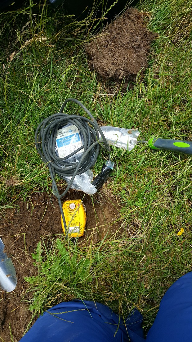
14 Comments
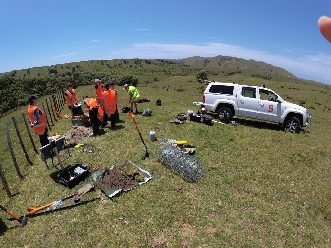 With our seismometers tested, kit assembled and training complete, we split into five teams and hit the road on a mission to find our first deployment sites. This turned out be easier for some than for others.
In order to acquire a detailed 3D image of the subsurface geology, our seismometers must be spaced roughly 2km apart in a grid across the Gisborne region. But choosing a deployment site is not as straightforward as it sounds. Our 6TD instruments are made to detect even the smallest of ground movements associated with earthquake activity and are therefore super sensitive to noise such as road traffic rumbling, trees rustling, streams flowing, power lines buzzing, and even electric fences humming. And as the majority of the area is farmland, our biggest contender is the livestock itself. Not only will they generate noise as they amble about the field but curious cows may fancy a nibble on the cables and pull our seismometers out the ground! To combat this we build sturdy fences around our deployment sites. As if that wasn't tricky enough in rural New Zealand we also have to ensure our solar panels get lots of light and our GPS has a good signal from the satellites. That means no hiding in the bushes. So you can see how finding the perfect spot may take a little time! In fact, our perseverance to hunt down the best deployment sites often means we're splashing through streams along bumpy offroad tracks, strapping our helmets on for a hair-raising ride in an LUV, or when all else fails lugging the equipment up a valley on foot. Our efforts paid off though. Let's just hope that fence holds! Well, now we've chosen a perfect site, let's put a seismometer in the ground! Wondering what that looks like? Stay tuned... And if you just can't wait, catch us on Twitter: @NZ3D_FWI 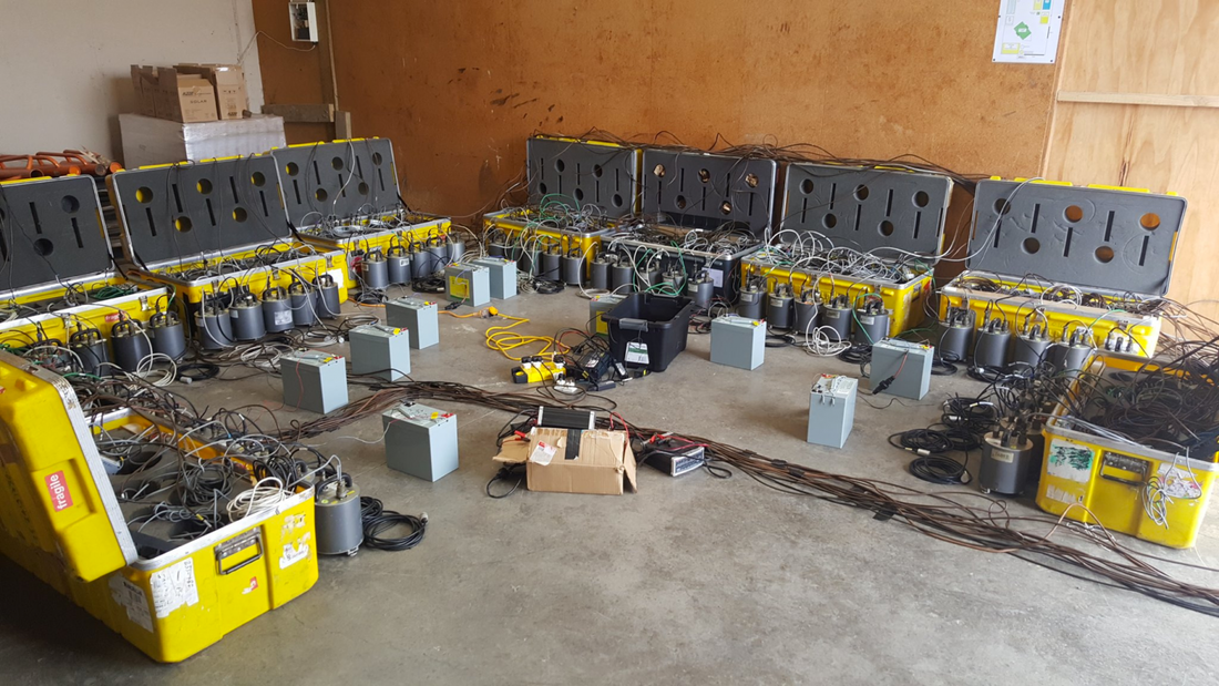 We have lift off! Years of planning, months of preparation and hours of travelling have culminated in a keen team of international scientists assembled in Gisborne ready to investigate the fascinating geology of the Hikurangi subduction zone. The Hikurangi subduction zone is particularly shallow which makes it more accessible and easier to study than others around the world. It has consequently attracted international interest and funding from scientists attempting to understand plate boundary tectonics and the natural hazards with which they are associated. Over the next few weeks Project NZ3D will install around 100 seismometers in the Gisborne region. These instruments will record the ground shaking associated with earthquake activity and allow us to image the subsurface structure of the plate boundary lying off the east coast. This research is part of a larger series of projects which aim to help us understand the behaviour of the subduction zone how to minimise the risk posed to communities along the east coast from earthquakes and tsunamis. The scientific team comprises researchers, technicians and students from far flung corners of the world such as Imperial College London and SEIS-UK as well as those a little closer to home from Victoria University and GNS Sciences. So what did we do on day 1? Recover from jet lag? A spot of sight-seeing? Nope, we got stuck straight in testing the equipment in a garage on an industrial estate... who said science was glamorous? Once we were sure we had everything in order, it was time head to our first field site and practice the full deployment. What could go wrong, right? Stay tuned, more on this coming soon! And if you just can't wait, catch us on Twitter: @NZ3D_FWI 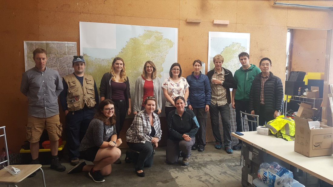 |
AuthorThe NZ3D FWI team consists of over 20 scientists from the UK and New Zealand who will be involved in installing over 200 seismometers! Archives
February 2018
Categories |
 RSS Feed
